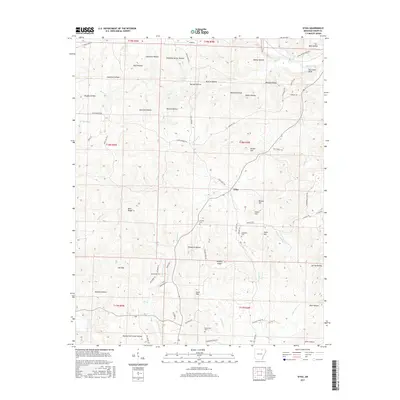
2017 Map of Sitka
USGS Topo · Published 2017About this map
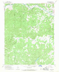
Sitka sits at the center of this landscape in northern Arkansas, where a network of ridge roads and hollows defines the local geography. The area's topography is marked by numerous family-named landmarks and natural features, including the prominent Hurricane Bluff overlooking the Spring River in the northeast corner. This watercourse, along with Upton Cr and Rock Cr, carves deep valleys through the terrain. The map captures a rural community structure centered around small family plots and local landmarks, with Schales Cem, Hopewell Cem, and Buchannan Cem serving as significant points for genealogical research. Distinctive elevations such as Divide Hill, Tater Hill, and Tyner Hill rise above the drainage basins of Mill Cr and Hurricane Cr. The distribution of residential access via roads like Summerfield Creek Rd and Hickory Ridge Rd reflects a long-standing settlement pattern within the townships of the Ozark foothills.
Find a feature on this map
82 named features on this map. Tap any name to fly to it.
Don’t see what you’re looking for? This feature index may not catch every label — zoom into the map to look around manually.
Map Details
Editions of this 2017 Sitka Map
This is the sole edition of this map. No revisions or reprints were ever made.
Other maps of this area

1957 · Poplar Bluff
USGS Topo · 1:250,000

1959 · Poplar Bluff
USGS Topo · 1:250,000

1960 · Poplar Bluff
USGS Topo · 1:250,000
1961 · Evening Shade
USGS Topo · 1:24,000

1962 · Stuart
USGS Topo · 1:24,000

1962 · Ash Flat
USGS Topo · 1:24,000
1965 · Poughkeepsie
USGS Topo · 1:24,000
1965 · Smithville
USGS Topo · 1:24,000

1968 · Hardy
USGS Topo · 1:24,000
1968 · Ravenden
USGS Topo · 1:24,000