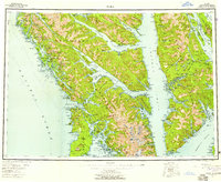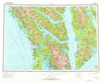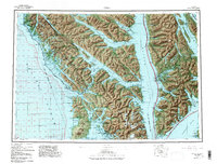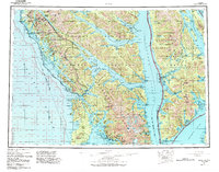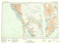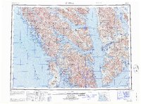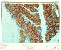
1951 Map of Sitka
USGS Topo · Published 1960About this map
Sitka and the surrounding islands of the Alexander Archipelago are captured here just after mid-century, following years of intensive hydrographic and topographic surveying. The landscape is defined by the deep glacial fjords of Lisianski Inlet, Tenakee Inlet, and Peril Strait, which served as the primary thoroughfares for the region's maritime economy. On the western flank of Kruzof Island, the dormant volcanic cone of Mount Edgecumbe stands as a prominent navigational landmark for vessels entering Sitka Sound. The map reveals a transition in coastal settlement, documenting established villages like Angoon and Killisnoo alongside industrial outposts and military remnants. Traces of earlier eras are visible at Old Sitka (Ruins), while the presence of the Army Camp (Aband) near the coast reflects the area's strategic significance during the preceding decades. From the cannery at Pelican to the isolated St John Baptist Mission, this record details the remote outposts of the First Judicial Division.
Find a feature on this map
81 named features on this map. Tap any name to fly to it.
Don’t see what you’re looking for? This feature index may not catch every label — zoom into the map to look around manually.
Map Details
Editions of this 1951 Sitka Map
6 editions found