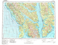
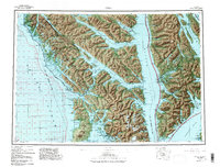
1951 Map of Sitka
USGS Topo · Published 1988About this map
Sitka serves as the focal point of this coastal survey, which captures the complex archipelago of Southeast Alaska at mid-century. The landscape is defined by the massive landforms of Chichagof Island, Baranof Island, and Admiralty Island, separated by the deep navigable waters of Chatham Strait and Peril Strait. Settlement patterns reflect a deep reliance on the sea, with communities like Pelican, Angoon, and Tenakee Springs hugging the rugged shorelines of protected inlets.
Find a feature on this map
70 named features on this map. Tap any name to fly to it.
Don’t see what you’re looking for? This feature index may not catch every label — zoom into the map to look around manually.
Map Details
Editions of this 1951 Sitka Map
6 editions found

Other maps of this area

1948 · Juneau A-3
USGS Topo · 1:63,360

1948 · Sitka B-3
USGS Topo · 1:63,360

1948 · Juneau A-4
USGS Topo · 1:63,360

1948 · Sitka D-1
USGS Topo · 1:63,360

1948 · Sitka B-1
USGS Topo · 1:63,360

1948 · Sitka A-5
USGS Topo · 1:63,360

1948 · Sitka A-3
USGS Topo · 1:63,360

1948 · Sitka C-7
USGS Topo · 1:63,360

1948 · Sitka C-2
USGS Topo · 1:63,360

1948 · Sitka A-2
USGS Topo · 1:63,360