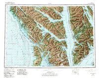
1951 Map of Sitka
USGS Topo · Published 1988About this map
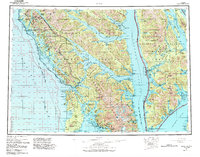
Chichagof Island, Baranof Island, and Admiralty Island dominate this mid-century maritime survey, documenting the intricate coastal landscape of the Alexander Archipelago. The regional hub of Sitka is situated on the western shore of Baranof Island, sheltered from the open Pacific by Kruzof Island and its prominent Mount Edgecumbe volcanic peak. Small coastal outposts like Pelican, Tenakee Springs, and Angoon are shown at the water's edge, highlighting the dependence on marine transport through waterways such as Chatham Strait and Peril Strait. While much of the land is managed under the Tongass National Forest, the map also identifies specific human infrastructure including a local Army Camp and various Cem and Mine sites. The inclusion of the Admiralty Island National Monument Wilderness reflects the shifting focus toward large-scale conservation in the latter half of the 20th century.
Find a feature on this map
102 named features on this map. Tap any name to fly to it.
Don’t see what you’re looking for? This feature index may not catch every label — zoom into the map to look around manually.
Map Details
Editions of this 1951 Sitka Map
6 editions found

Other maps of this area

1948 · Juneau A-3
USGS Topo · 1:63,360

1948 · Sitka B-3
USGS Topo · 1:63,360

1948 · Juneau A-4
USGS Topo · 1:63,360

1948 · Sitka D-1
USGS Topo · 1:63,360

1948 · Sitka B-1
USGS Topo · 1:63,360

1948 · Sitka A-5
USGS Topo · 1:63,360

1948 · Sitka A-3
USGS Topo · 1:63,360

1948 · Sitka C-7
USGS Topo · 1:63,360

1948 · Sitka C-2
USGS Topo · 1:63,360

1948 · Sitka A-2
USGS Topo · 1:63,360