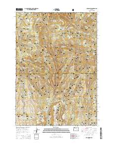
2014 Map of Six Corners
USGS Topo · Published 2014About this map
Ochoco National Forest defines the landscape of this high-country terrain, where the headwaters of numerous creeks and springs originate. The area is marked by a network of timber and access roads, including Nat For Dev Rd 38 and Mascall Rd, which navigate between prominent elevations such as Bear Mtn and Wolf Ridge. The map reveals a high concentration of small-scale water management features, including Reed Reservoir, Miles Reservoir, and Scab Reservoir, likely serving livestock or forest management in this arid environment. Significant open spaces like Bear Meadows, Potter Meadows, and Podo Meadows offer clearings amidst the timbered slopes. Along the Wheeler Co Crook Co boundary, numerous named water sources such as Survey Spring and Noble Garden Spring highlight the critical importance of water location in the Central Oregon interior.
Find a feature on this map
65 named features on this map. Tap any name to fly to it.
Don’t see what you’re looking for? This feature index may not catch every label — zoom into the map to look around manually.
Map Details
Editions of this 2014 Six Corners Map
This is the sole edition of this map. No revisions or reprints were ever made.
Other maps of this area

1932 · Dayville
USGS Topo · 1:125,000

1936 · Dayville
USGS Topo · 1:125,000

1955 · Canyon City
USGS Topo · 1:250,000

1959 · Canyon City
USGS Topo · 1:250,000

1966 · Antone
USGS Topo · 1:24,000
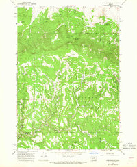
1966 · Derr Meadows
USGS Topo · 1:24,000

1966 · Little Summit Prairie
USGS Topo · 1:24,000

1966 · Six Corners
USGS Topo · 1:24,000

1972 · Wolf Mountain
USGS Topo · 1:24,000

1972 · Day Basin
USGS Topo · 1:24,000