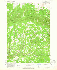
1966 Map of Derr Meadows
USGS Topo · Published 1968About this map
Ochogo National Forest dominates this mid-1960s terrain, where the boundary between Wheeler and Crook Counties zigzags through a high-altitude landscape of meadows and springs. The map documents the high-country infrastructure of the era, from the Derr Guard Station and Derr Camp to specialized features like the Buck Point Troughs. The most significant historical marker is Camp Watson (Site) in the northeast corner, accompanied by a small Cemetery, providing a fixed point for local-history researchers tracing the early military and pioneer presence in these mountains.
Find a feature on this map
44 named features on this map. Tap any name to fly to it.
Don’t see what you’re looking for? This feature index may not catch every label — zoom into the map to look around manually.
Map Details
Editions of this 1966 Derr Meadows Map
2 editions found
Other maps of this area

1926 · Mitchell
USGS Topo · 1:125,000

1932 · Dayville
USGS Topo · 1:125,000

1936 · Dayville
USGS Topo · 1:125,000

1953 · Richmond
USGS Topo · 1:62,500

1955 · Bend
USGS Topo · 1:250,000

1955 · Canyon City
USGS Topo · 1:250,000

1957 · Bend
USGS Topo · 1:250,000

1958 · Bend
USGS Topo · 1:250,000

1959 · Canyon City
USGS Topo · 1:250,000

1966 · Keys Creek
USGS Topo · 1:24,000