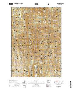
2020 Map of Six Corners
USGS Topo · Published 2020About this map
Ochoco National Forest defines this high-desert landscape in central Oregon, where a complex network of springs and drainages feed into the larger watershed. The namesake junction at Six Corners serves as a lone point of human settlement amidst a terrain dominated by significant peaks like Bear Mtn and the prominent Wolf Ridge. The map illustrates a reliance on managed water resources for forestry and livestock, indicated by numerous man-made catchments including Hornet Reservoir, Frog Reservoir, and Scab Reservoir.
Find a feature on this map
49 named features on this map. Tap any name to fly to it.
Don’t see what you’re looking for? This feature index may not catch every label — zoom into the map to look around manually.
Map Details
Editions of this 2020 Six Corners Map
This is the sole edition of this map. No revisions or reprints were ever made.
Other maps of this area

1932 · Dayville
USGS Topo · 1:125,000

1936 · Dayville
USGS Topo · 1:125,000

1955 · Canyon City
USGS Topo · 1:250,000

1959 · Canyon City
USGS Topo · 1:250,000

1966 · Antone
USGS Topo · 1:24,000
1966 · Derr Meadows
USGS Topo · 1:24,000

1966 · Little Summit Prairie
USGS Topo · 1:24,000

1966 · Six Corners
USGS Topo · 1:24,000

1972 · Wolf Mountain
USGS Topo · 1:24,000

1972 · Day Basin
USGS Topo · 1:24,000