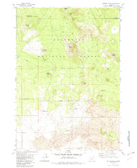
1982 Map of Sixteen Butte
USGS Topo · Published 1982About this map
Sixteen Butte rises as a central landmark within the Deschutes National Forest, marking a landscape defined by volcanic geology and high desert flora at the border of Deschutes and Lake counties. This 1982 survey illustrates a transition from the timbered heights of Wigtop Butte and Deadlog Butte to the stark expanses of lava fields in the south. A notable botanical landmark, Oregons Largest Juniper Tree, is specifically noted in the eastern section near Buck Butte, providing a rare point of interest for naturalists and historians.
Find a feature on this map
23 named features on this map. Tap any name to fly to it.
Don’t see what you’re looking for? This feature index may not catch every label — zoom into the map to look around manually.
Map Details
Editions of this 1982 Sixteen Butte Map
2 editions found
Other maps of this area

1931 · Newberry Crater
USGS Topo · 1:125,000

1935 · Newberry Crater
USGS Topo · 1:125,000

1955 · Crescent
USGS Topo · 1:250,000

1957 · Crescent
USGS Topo · 1:250,000

1958 · Crescent
USGS Topo · 1:250,000

1970 · Crescent
USGS Topo · 1:250,000

1979 · Crescent
USGS Topo · 1:100,000

1981 · Fox Butte
USGS Topo · 1:24,000

1981 · Hogback Butte
USGS Topo · 1:24,000

1981 · Cougar Mtn
USGS Topo · 1:24,000