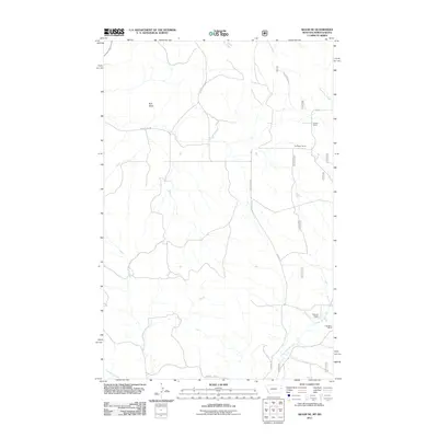
2011 Map of Skaar NE
USGS Topo · Published 2011About this map
Bull Butte rises as a prominent landmark over a landscape defined by traditional Western ranching operations and a network of seasonal drainage systems. The map documents long-established family operations including the Folkvord Ranch, Kupper Ranch, Thompson Ranch, and C Madison Ranch, illustrating the sparse but persistent settlement pattern of this region near the Montana and North Dakota border. The terrain is dissected by numerous named watercourses such as Poison Spring Creek, One-O-One Creek, O'Brien Creek, and Deadman Creek, which dictate the placement of local infrastructure like County Rd 354 and Skaar Rd. This 2011 survey captures the rural character of Richland County just as modern technological updates were being integrated into traditional topographic records, preserving the specific locations of homesteads and grazing lands for future researchers.
Find a feature on this map
23 named features on this map. Tap any name to fly to it.
Don’t see what you’re looking for? This feature index may not catch every label — zoom into the map to look around manually.
Map Details
Editions of this 2011 Skaar NE Map
This is the sole edition of this map. No revisions or reprints were ever made.
Other maps of this area

1909 · Glendive
USGS Topo · 1:250,000

1953 · Watford City
USGS Topo · 1:250,000

1954 · Glendive
USGS Topo · 1:250,000

1957 · Glendive
USGS Topo · 1:250,000

1957 · Watford City
USGS Topo · 1:250,000

1958 · Glendive
USGS Topo · 1:250,000

1966 · Piche
USGS Topo · 1:24,000

1966 · Skaar NW
USGS Topo · 1:24,000

1967 · Watford City
USGS Topo · 1:250,000

1972 · Sidney SE
USGS Topo · 1:24,000