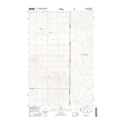
2014 Map of Skaar NE
USGS Topo · Published 2014About this map
Little Missouri National Grassland dominates the eastern half of this landscape, marking the rugged transition where the high plains of Montana meet the North Dakota border. The terrain is defined by dramatic elevation shifts, anchored by Bull Butte in the northwest and a network of seasonal drainages that shape the local geography. Watercourses like Poison Spring Cr and Deadman Cr carve through the draws, illustrating the natural drainage patterns that have historically dictated land use and ranching boundaries in this arid region.
Find a feature on this map
15 named features on this map. Tap any name to fly to it.
Don’t see what you’re looking for? This feature index may not catch every label — zoom into the map to look around manually.
Map Details
Editions of this 2014 Skaar NE Map
This is the sole edition of this map. No revisions or reprints were ever made.
Other maps of this area

1909 · Glendive
USGS Topo · 1:250,000

1953 · Watford City
USGS Topo · 1:250,000

1954 · Glendive
USGS Topo · 1:250,000

1957 · Glendive
USGS Topo · 1:250,000

1957 · Watford City
USGS Topo · 1:250,000

1958 · Glendive
USGS Topo · 1:250,000

1966 · Piche
USGS Topo · 1:24,000

1966 · Skaar NW
USGS Topo · 1:24,000

1967 · Watford City
USGS Topo · 1:250,000

1972 · Sidney SE
USGS Topo · 1:24,000