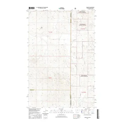
2017 Map of Skaar NE
USGS Topo · Published 2017About this map
The Little Missouri National Grassland dominates the eastern landscape of this quadrangle, where the High Plains transition across the state line from Montana into North Dakota. This 2017 survey documents a sparsely settled region defined by its sections and range lines, where the topography is punctuated by Bull Butte. The drainage patterns of the northern badlands are traced by One-O-One Cr in the northeast and Poison Spring Cr to the south. A network of rural county routes, including Co Rd 108 and Skaar Rd, provides access through the administrative boundaries of Richland, McKenzie, and Wibaux counties. The map reflects a modern inventory of the rugged public lands and private holdings that characterize the borderlands of the Missouri Plateau.
Find a feature on this map
19 named features on this map. Tap any name to fly to it.
Don’t see what you’re looking for? This feature index may not catch every label — zoom into the map to look around manually.
Map Details
Editions of this 2017 Skaar NE Map
This is the sole edition of this map. No revisions or reprints were ever made.
Other maps of this area

1909 · Glendive
USGS Topo · 1:250,000

1953 · Watford City
USGS Topo · 1:250,000

1954 · Glendive
USGS Topo · 1:250,000

1957 · Glendive
USGS Topo · 1:250,000

1957 · Watford City
USGS Topo · 1:250,000

1958 · Glendive
USGS Topo · 1:250,000

1966 · Piche
USGS Topo · 1:24,000

1966 · Skaar NW
USGS Topo · 1:24,000

1967 · Watford City
USGS Topo · 1:250,000

1972 · Sidney SE
USGS Topo · 1:24,000