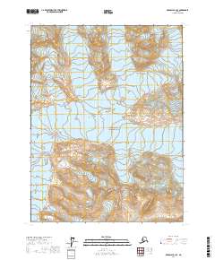
2017 Map of Skagway A-3 SE
USGS Topo · Published 2017About this map
Glacier Bay National Park encompasses the majority of this territory, characterized by significant ice formations and steep elevation changes. Central to the sheet is the Casement Glacier, which dominates the interior drainage and illustrates the ice-driven topography of the region. This 2017 study details the vast glacial reaches before they descend toward the coastal inlets outside the quadrangle boundaries. Rising above the northern ice fields, Sitth-gha-ee Peak serves as a prominent landmark for the surrounding terrain. The map provides a detailed look at the Public Land Survey System grid within the park, specifically highlighting townships such as t32s r57e and t33s r57e, which are essential for understanding land management and historical boundary lines in this protected wilderness.
Find a feature on this map
7 named features on this map. Tap any name to fly to it.
Don’t see what you’re looking for? This feature index may not catch every label — zoom into the map to look around manually.
Map Details
Editions of this 2017 Skagway A-3 SE Map
This is the sole edition of this map. No revisions or reprints were ever made.
Other maps of this area

1949 · Juneau D-6
USGS Topo · 1:63,360

1951 · Juneau
USGS Topo · 1:250,000

1952 · Skagway
USGS Topo · 1:250,000

1954 · Skagway A-3
USGS Topo · 1:63,360

1954 · Skagway A-2
USGS Topo · 1:63,360

1961 · Skagway
USGS Topo · 1:250,000

1962 · Juneau
USGS Topo · 1:250,000
2004 · Skagway A-2
USGS Topo · 1:63,360
2017 · Skagway A-3 SW
USGS Topo · 1:25,000
2017 · Skagway A-3 NE
USGS Topo · 1:25,000