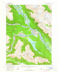
1954 Map of Skagway B-3
USGS Topo · Published 1964About this map
Klukwan and the surrounding river valleys are captured here in the mid-1950s, highlighting a landscape defined by the confluence of major glacial waterways. The Chilkat River serves as the central artery, joined by the Klehini River near the settlement of Wells. This period shows the coexistence of traditional routes and modern infrastructure, as the historic Dalton Trail runs parallel to the Haines Highway and a prominent Pipeline.
Find a feature on this map
25 named features on this map. Tap any name to fly to it.
Don’t see what you’re looking for? This feature index may not catch every label — zoom into the map to look around manually.
Map Details
Editions of this 1954 Skagway B-3 Map
2 editions found
Other maps of this area

1948 · Skagway C-4
USGS Topo · 1:63,360

1948 · Skagway C-3
USGS Topo · 1:63,360

1948 · Skagway C-2
USGS Topo · 1:63,360

1951 · Skagway C-2
USGS Topo · 1:63,360

1952 · Skagway
USGS Topo · 1:250,000

1954 · Skagway B-2
USGS Topo · 1:63,360

1954 · Skagway A-3
USGS Topo · 1:63,360

1954 · Skagway A-2
USGS Topo · 1:63,360

1954 · Skagway B-3
USGS Topo · 1:63,360

1954 · Skagway B-4
USGS Topo · 1:63,360