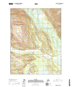
2017 Map of Skagway B-3 NW
USGS Topo · Published 2017About this map
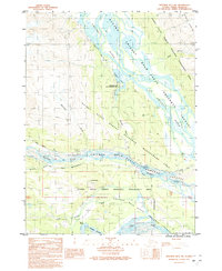
The Chilkat River floodplains dominate the landscape of this region north of Haines, where braided water channels and wetlands create a complex riparian environment. Small settlements like Mosquito Lake and Moose Valley are established along the valley floor, connected by a network of local roads such as Kelsall Road and Moose Valley Road. The map reveals the critical intersection of multiple waterways, including the confluence of the Klehini River and the Tsirku River with the main Chilkat artery.
Find a feature on this map
26 named features on this map. Tap any name to fly to it.
Don’t see what you’re looking for? This feature index may not catch every label — zoom into the map to look around manually.
Map Details
Editions of this 2017 Skagway B-3 NW Map
This is the sole edition of this map. No revisions or reprints were ever made.
Other maps of this area

1948 · Skagway C-4
USGS Topo · 1:63,360

1948 · Skagway C-3
USGS Topo · 1:63,360

1952 · Skagway
USGS Topo · 1:250,000

1954 · Skagway B-3
USGS Topo · 1:63,360

1954 · Skagway B-4
USGS Topo · 1:63,360
1954 · Skagway C-4
USGS Topo · 1:63,360
1954 · Skagway C-3
USGS Topo · 1:63,360

1961 · Skagway
USGS Topo · 1:250,000
1991 · Skagway B-3 SW
USGS Topo · 1:25,000
1991 · Skagway B-3 NW
USGS Topo · 1:25,000