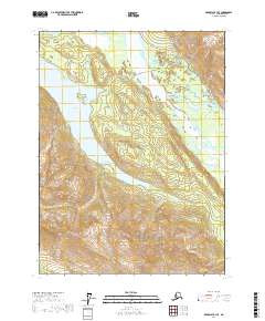
2017 Map of Skagway B-3 SE
USGS Topo · Published 2017About this map
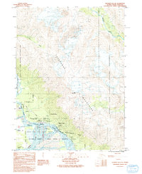
Chilkat Lake dominates this 2017 terrain study of the Haines Borough region, where the glacial waters are punctuated by the prominent Birch Island. The landscape is defined by the sharp descent of the coastal mountains, with drainage provided by the Tsirku River at the northern edge and Ackman Cr to the south. The Haines Highway cuts through the northeast corner, following the river valley and providing a critical transportation link through this corridor of the Alaska Panhandle. The map illustrates the complex hydrography of the region, where wetlands and river systems interface with the steep relief typical of the Chilkat Range and surrounding wilderness near the Canadian border.
Find a feature on this map
9 named features on this map. Tap any name to fly to it.
Don’t see what you’re looking for? This feature index may not catch every label — zoom into the map to look around manually.
Map Details
Editions of this 2017 Skagway B-3 SE Map
This is the sole edition of this map. No revisions or reprints were ever made.
Other maps of this area

1952 · Skagway
USGS Topo · 1:250,000

1954 · Skagway B-2
USGS Topo · 1:63,360

1954 · Skagway A-3
USGS Topo · 1:63,360

1954 · Skagway A-2
USGS Topo · 1:63,360

1954 · Skagway B-3
USGS Topo · 1:63,360

1961 · Skagway
USGS Topo · 1:250,000
1991 · Skagway B-3 SW
USGS Topo · 1:25,000
1991 · Skagway B-3 NW
USGS Topo · 1:25,000
1991 · Skagway B-2 SW
USGS Topo · 1:25,000
1991 · Skagway B-3 NE
USGS Topo · 1:25,000