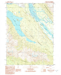
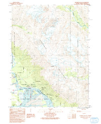
1991 Map of Skagway B-3 SE
USGS Topo · Published 1991About this map
Chilkat Lake and the complex braided channels of the Chilkat River dominate this 1991 provisional survey of the Haines Borough region. The map captures a wilderness area defined by rigorous conservation boundaries, including the Chilkat State Critical Habitat Area and the Chilkat Bald Eagle River Preserve. Human presence is marked by the historic Dalton Trail and the Haines Highway, which follow the river's path through the valley. Of particular interest to local historians is the location of Klucktoo, noted as a site rather than an active settlement, alongside the distinctive Nineteentnmile Slide. The terrain is steeply defined by the Chilkat Ridge and Takhin Ridge, showcasing the intersection of transport corridors and protected wildlife habitats in the late twentieth century.
Find a feature on this map
18 named features on this map. Tap any name to fly to it.
Don’t see what you’re looking for? This feature index may not catch every label — zoom into the map to look around manually.
Map Details
Editions of this 1991 Skagway B-3 SE Map
This is the sole edition of this map. No revisions or reprints were ever made.
Other maps of this area

1952 · Skagway
USGS Topo · 1:250,000

1954 · Skagway B-2
USGS Topo · 1:63,360

1954 · Skagway A-3
USGS Topo · 1:63,360

1954 · Skagway A-2
USGS Topo · 1:63,360

1954 · Skagway B-3
USGS Topo · 1:63,360

1961 · Skagway
USGS Topo · 1:250,000
1991 · Skagway B-3 SW
USGS Topo · 1:25,000
1991 · Skagway B-3 NW
USGS Topo · 1:25,000
1991 · Skagway B-2 SW
USGS Topo · 1:25,000
1991 · Skagway B-3 NE
USGS Topo · 1:25,000