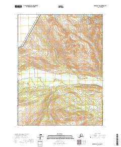
2017 Map of Skagway B-4 NE
USGS Topo · Published 2017About this map
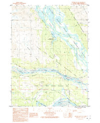
Covenant Life sits near the southern bank of the braided Klehini River, serving as a primary settlement point in this reach of the Haines Borough. The landscape is defined by the convergence of steep alpine terrain and river-valley transit, where the modern Haines Highway and Old Haines Highway parallel the water. To the north, prominent peaks like Mt Cheetdeekahyu and Four Winds Mtn overlook Mosquito Lake, while the southern sector is dominated by a complex network of drainages including Porcupine Cr, McKinley Cr, and Cahoon Cr. The international boundary with Canada cuts across the northwestern corner, marking the rugged divide between Alaska and British Columbia. This area illustrates the specialized mountain-and-river geography typical of the northern Panhandle, where glacial meltwater feeds systems like the Little Salmon River.
Find a feature on this map
27 named features on this map. Tap any name to fly to it.
Don’t see what you’re looking for? This feature index may not catch every label — zoom into the map to look around manually.
Map Details
Editions of this 2017 Skagway B-4 NE Map
This is the sole edition of this map. No revisions or reprints were ever made.
Other maps of this area

1948 · Skagway C-4
USGS Topo · 1:63,360

1948 · Skagway C-3
USGS Topo · 1:63,360

1952 · Skagway
USGS Topo · 1:250,000

1954 · Skagway B-3
USGS Topo · 1:63,360

1954 · Skagway B-4
USGS Topo · 1:63,360
1954 · Skagway C-4
USGS Topo · 1:63,360
1954 · Skagway C-3
USGS Topo · 1:63,360

1961 · Skagway
USGS Topo · 1:250,000
1991 · Skagway B-3 SW
USGS Topo · 1:25,000
1991 · Skagway B-3 NW
USGS Topo · 1:25,000