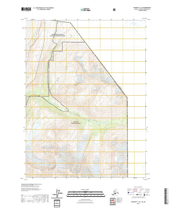
2021 Map of Skagway C-1 SE
USGS Topo · Published 2021About this map
Klondike Gold Rush National Historical Park and the Tongass National Forest converge in this high-altitude landscape along the border of Alaska and Canada. The map illustrates the difficult path of the Klondike Highway as it winds northward through the mountains toward Summit Lake. This region is defined by deep incisions in the earth, such as the Glacier Gorge and Warm Pass Valley, which channel the Skagway River and its various tributaries including the White Pass Fork.
Find a feature on this map
17 named features on this map. Tap any name to fly to it.
Don’t see what you’re looking for? This feature index may not catch every label — zoom into the map to look around manually.
Map Details
Editions of this 2021 Skagway C-1 SE Map
This is the sole edition of this map. No revisions or reprints were ever made.
Other maps of this area

1948 · Skagway C-1
USGS Topo · 1:63,360

1949 · Atlin
USGS Topo · 1:250,000

1949 · Skagway B-1
USGS Topo · 1:63,360

1951 · Skagway C-1
USGS Topo · 1:63,360

1951 · Atlin
USGS Topo · 1:250,000

1951 · Skagway B-1
USGS Topo · 1:63,360

1952 · Skagway
USGS Topo · 1:250,000
1960 · Atlin B-8
USGS Topo · 1:63,360

1960 · Atlin
USGS Topo · 1:250,000

1961 · Skagway
USGS Topo · 1:250,000