
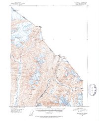
1951 Map of Skagway C-1
USGS Topo · Published 1952About this map
Chilkoot Pass and White Pass dominate this 1951 survey of the boundary between British Columbia and Alaska. This mountainous terrain marks the critical gateway into the interior during the gold rush era, showing the infrastructure developed to traverse these high-altitude gaps. The White Pass and Yukon route is clearly delineated, tracking alongside the White Pass Fork toward Summit Lake. This railroad and trail network provided a mechanical alternative to the grueling manual labor required at Chilkoot Pass.
Find a feature on this map
36 named features on this map. Tap any name to fly to it.
Don’t see what you’re looking for? This feature index may not catch every label — zoom into the map to look around manually.
Map Details
Editions of this 1951 Skagway C-1 Map
2 editions found
Other maps of this area

1948 · Skagway C-2
USGS Topo · 1:63,360

1948 · Skagway C-1
USGS Topo · 1:63,360

1949 · Atlin
USGS Topo · 1:250,000

1949 · Skagway B-1
USGS Topo · 1:63,360
1949 · Skagway D-2
USGS Topo · 1:63,360

1951 · Atlin
USGS Topo · 1:250,000

1951 · Skagway B-1
USGS Topo · 1:63,360

1951 · Skagway C-2
USGS Topo · 1:63,360

1952 · Skagway
USGS Topo · 1:250,000

1954 · Skagway B-2
USGS Topo · 1:63,360