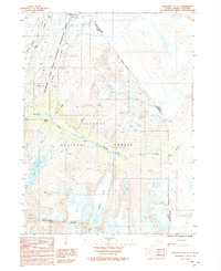
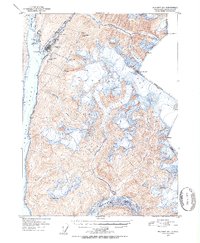
1992 Map of Skagway C-1 SE
USGS Topo · Published 1992About this map
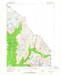
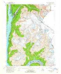
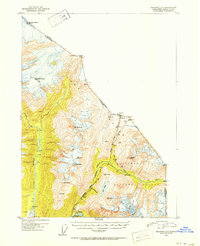
Klondike Gold Rush National Historical Park preserves the difficult passage through the coastal mountains into the interior of British Columbia. This survey details the critical transportation corridor following the Skagway River, where the White Pass and Yukon Route railway and the Klondike Highway traverse the high terrain. The map traces the historic path toward the White Pass summit, including engineering landmarks like the New Tunnel and the Old Tunnel. Beyond the rail and road links, the landscape is defined by massive ice features such as Laughton Glacier and the steep drops of Pitchfork Falls. Evidence of former habitation and mining-era infrastructure appears at Heney (Site) and Inspiration Point. The dramatic elevation changes are anchored by the Sawtooth Range and the secluded waters of Goat Lake to the west.
Find a feature on this map
26 named features on this map. Tap any name to fly to it.
Don’t see what you’re looking for? This feature index may not catch every label — zoom into the map to look around manually.
Map Details
Editions of this 1992 Skagway C-1 SE Map
This is the sole edition of this map. No revisions or reprints were ever made.
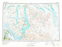
Other maps of this area
1948 · Skagway C-1
USGS Topo · 1:63,360

1949 · Atlin
USGS Topo · 1:250,000
1949 · Skagway B-1
USGS Topo · 1:63,360
1951 · Skagway C-1
USGS Topo · 1:63,360

1951 · Atlin
USGS Topo · 1:250,000
1951 · Skagway B-1
USGS Topo · 1:63,360

1952 · Skagway
USGS Topo · 1:250,000
1960 · Atlin B-8
USGS Topo · 1:63,360
1960 · Atlin
USGS Topo · 1:250,000

1961 · Skagway
USGS Topo · 1:250,000