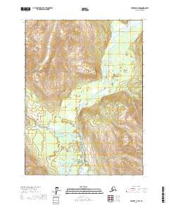
2017 Map of Skagway C-3 SW
USGS Topo · Published 2017About this map
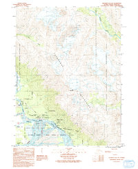
Chilkat River and Kelsall River converge in this southeastern Alaska landscape, where glacial waters carve through the steep terrain of the Haines Borough. This 2017 survey details the complex braided river systems and drainage basins, including the small Nataga Cr tributary. Human presence is concentrated along the Kelsall Road, which skirts the riverbanks and provides access to the valley floor. High-elevation landmarks such as Tahitkah Mtn to the north and Klutshah Mtn to the south define the skyline, marking the divide between river drainages. The map provides a precise look at the township and range divisions, such as t27s r55e, as they were organized in the early 21st century for land management and public land surveys.
Find a feature on this map
10 named features on this map. Tap any name to fly to it.
Don’t see what you’re looking for? This feature index may not catch every label — zoom into the map to look around manually.
Map Details
Editions of this 2017 Skagway C-3 SW Map
This is the sole edition of this map. No revisions or reprints were ever made.
Other maps of this area

1948 · Skagway C-4
USGS Topo · 1:63,360

1948 · Skagway C-3
USGS Topo · 1:63,360

1952 · Skagway
USGS Topo · 1:250,000

1954 · Skagway B-3
USGS Topo · 1:63,360

1954 · Skagway B-4
USGS Topo · 1:63,360
1954 · Skagway C-4
USGS Topo · 1:63,360
1954 · Skagway C-3
USGS Topo · 1:63,360

1961 · Skagway
USGS Topo · 1:250,000
1991 · Skagway B-3 NW
USGS Topo · 1:25,000
1991 · Skagway B-3 NE
USGS Topo · 1:25,000