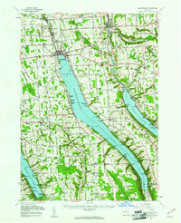
1955 Map of Skaneateles
USGS Topo · Published 1957About this map
Skaneateles Lake serves as the central anchor of this mid-1950s survey, surrounded by a landscape of established villages and productive agricultural uplands. The industrial legacy of the region is evident in the north, where the Skaneateles Short Line Railroad follows Skaneateles Creek through Skaneateles Falls and Mottville, while the historic Seneca Turnpike cuts east-west across the terrain. To the east, the deep basin of Otisco Lake is flanked by steep hillsides and small lakeside clusters like Borodino and Amber.
Find a feature on this map
81 named features on this map. Tap any name to fly to it.
Don’t see what you’re looking for? This feature index may not catch every label — zoom into the map to look around manually.
Map Details
Editions of this 1955 Skaneateles Map
2 editions found
Other maps of this area

1895 · Syracuse
USGS Topo · 1:62,500

1898 · Syracuse
USGS Topo · 1:62,500

1898 · Moravia
USGS Topo · 1:62,500

1899 · Auburn
USGS Topo · 1:62,500

1899 · Skaneateles
USGS Topo · 1:62,500

1900 · Baldwinsville
USGS Topo · 1:62,500

1900 · Tully
USGS Topo · 1:62,500

1902 · Skaneateles
USGS Topo · 1:62,500

1902 · Moravia
USGS Topo · 1:62,500

1902 · Genoa
USGS Topo · 1:62,500