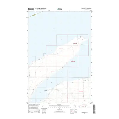
2014 Map of Skanee North
USGS Topo · Published 2014About this map
Point Abbaye marks the northernmost tip of the Abbaye Peninsula, a significant geographic feature of Lake Superior's southern shore. The shoreline is defined by numerous inlets including Finlander Bay, Keweenaw Bay, and Huron Bay, highlighting the maritime character of Baraga County. The settlement of Skanee serves as the local hub, supported by a network of family-named roads such as Liimatainen Rd, Ohman Rd, and Gauthier Rd, which reflect the region's cultural heritage. For those looking at local history, Skanee Cem is a notable landmark near Lightfoot Bay. Further inland, the map traces several watercourses like Peterson Cr and Gulskoog Cr, showing the drainage patterns through the wooded landscape toward the great lake.
Find a feature on this map
35 named features on this map. Tap any name to fly to it.
Don’t see what you’re looking for? This feature index may not catch every label — zoom into the map to look around manually.
Map Details
Editions of this 2014 Skanee North Map
This is the sole edition of this map. No revisions or reprints were ever made.
Other maps of this area

1954 · Traverse Island
USGS Topo · 1:24,000

1954 · Skanee
USGS Topo · 1:62,500

1954 · Keweenaw Bay
USGS Topo · 1:62,500

1958 · Hancock
USGS Topo · 1:250,000

1958 · Iron River
USGS Topo · 1:250,000

1960 · Iron River
USGS Topo · 1:250,000

1960 · Hancock
USGS Topo · 1:250,000

1961 · Iron River
USGS Topo · 1:250,000

1961 · Hancock
USGS Topo · 1:250,000

1966 · Hancock
USGS Topo · 1:250,000