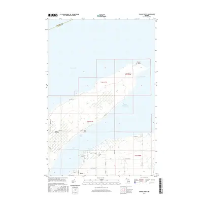
2017 Map of Skanee North
USGS Topo · Published 2017About this map
The Abbaye Peninsula extends into the cold waters of Lake Superior, creating a natural divider between Keweenaw Bay and Huron Bay. This northern Michigan landscape is defined by its dramatic shoreline, culminating at Point Abbaye and the smaller Lighthouse Point to the south. The settlement of Skanee serves as the primary hub at the base of the peninsula, where local life has long centered around the water and the timbered interior. Genealogists and local historians can locate the Skanee Cem along Pinery Cemetery Rd, a site reflecting the community's heritage near Lightfoot Bay. The map reveals a network of local routes like Lower Skanee Rd and Liimatainen Rd that navigate the wetlands and creeks, such as Peterson Cr and Gulskoog Cr, which drain into the surrounding bays.
Find a feature on this map
37 named features on this map. Tap any name to fly to it.
Don’t see what you’re looking for? This feature index may not catch every label — zoom into the map to look around manually.
Map Details
Editions of this 2017 Skanee North Map
This is the sole edition of this map. No revisions or reprints were ever made.
Other maps of this area

1954 · Traverse Island
USGS Topo · 1:24,000

1954 · Skanee
USGS Topo · 1:62,500

1954 · Keweenaw Bay
USGS Topo · 1:62,500

1958 · Hancock
USGS Topo · 1:250,000

1958 · Iron River
USGS Topo · 1:250,000

1960 · Iron River
USGS Topo · 1:250,000

1960 · Hancock
USGS Topo · 1:250,000

1961 · Iron River
USGS Topo · 1:250,000

1961 · Hancock
USGS Topo · 1:250,000

1966 · Hancock
USGS Topo · 1:250,000