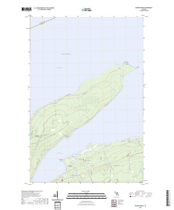
2023 Map of Skanee North
USGS Topo · Published 2023About this map
Point Abbaye marks the northernmost tip of the Abbaye Peninsula, a distinctive finger of land that separates Keweenaw Bay from Huron Bay in Lake Superior. The rugged geography of this Baraga County coastal area is defined by its numerous smaller inlets, including Finlander Bay and Lightfoot Bay. Local travel is dictated by long-established routes like Pt Abbaye Rd, which runs the length of the peninsula through township sections of t53n r30w and t53n r31w.
Find a feature on this map
39 named features on this map. Tap any name to fly to it.
Don’t see what you’re looking for? This feature index may not catch every label — zoom into the map to look around manually.
Map Details
Editions of this 2023 Skanee North Map
This is the sole edition of this map. No revisions or reprints were ever made.
Other maps of this area

1954 · Traverse Island
USGS Topo · 1:24,000

1954 · Skanee
USGS Topo · 1:62,500

1954 · Keweenaw Bay
USGS Topo · 1:62,500

1958 · Hancock
USGS Topo · 1:250,000

1958 · Iron River
USGS Topo · 1:250,000

1960 · Iron River
USGS Topo · 1:250,000

1960 · Hancock
USGS Topo · 1:250,000

1961 · Iron River
USGS Topo · 1:250,000

1961 · Hancock
USGS Topo · 1:250,000

1966 · Hancock
USGS Topo · 1:250,000