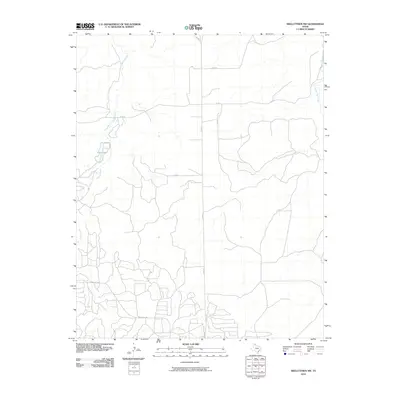
2010 Map of Skellytown NW
USGS Topo · Published 2010About this map
Spring Creek winds through the high plains of Hutchinson County, defining the drainage patterns of this sparsely populated Panhandle landscape. The area is characterized by its agricultural and ranching infrastructure, where a network of county roads like Co Rd 25 and Co Rd 26 grid the terrain between intermittent water sources. A small localized body of water known as Jims Lake sits along the western side of the quadrangle, while White Deer Creek appears in the northeast. The presence of Ranch Rd 1059 in the southern portion suggests a connection to the broader regional transportation system, likely supporting the movement of livestock or energy resources common to this part of Texas. This survey captures the quiet, functional layout of the region as it existed during the first decade of the 2000s.
Find a feature on this map
9 named features on this map. Tap any name to fly to it.
Don’t see what you’re looking for? This feature index may not catch every label — zoom into the map to look around manually.
Map Details
Editions of this 2010 Skellytown NW Map
This is the sole edition of this map. No revisions or reprints were ever made.
Other maps of this area

1953 · Plemons
USGS Topo · 1:24,000

1953 · Borger SE
USGS Topo · 1:24,000

1953 · Phillips
USGS Topo · 1:24,000

1954 · Amarillo
USGS Topo · 1:250,000

1958 · Amarillo
USGS Topo · 1:250,000

1963 · Skellytown
USGS Topo · 1:24,000

1965 · Lake Mc Connell
USGS Topo · 1:24,000

1970 · Phillips
USGS Topo · 1:24,000

1971 · Skellytown NW
USGS Topo · 1:24,000

1971 · Skellytown NE
USGS Topo · 1:24,000