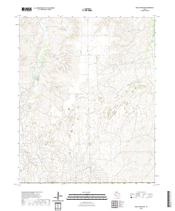
2022 Map of Skellytown NW
USGS Topo · Published 2022About this map
Spring Creek and its southern reaches wind through the high plains of the Texas Panhandle in this contemporary survey of Hutchinson County. The landscape is defined by the drainage networks of White Deer Creek and the notable White Deer Springs, which provide critical water sources in an otherwise arid environment. This area maintains a sparse, ranching-oriented character, with a strictly organized grid of county roads such as Co Rd 25 and Co Rd X providing access across the undulating terrain. A distinct local landmark, Jims Lake, is situated near the junction of Jim Lake Rd, illustrating the importance of specific water catchments for local land management. The presence of Ranch Rd 1059 in the southwest corner indicates the more developed transit links connecting these remote grazing lands to larger regional hubs.
Find a feature on this map
14 named features on this map. Tap any name to fly to it.
Don’t see what you’re looking for? This feature index may not catch every label — zoom into the map to look around manually.
Map Details
Editions of this 2022 Skellytown NW Map
This is the sole edition of this map. No revisions or reprints were ever made.
Other maps of this area

1953 · Plemons
USGS Topo · 1:24,000

1953 · Borger SE
USGS Topo · 1:24,000

1953 · Phillips
USGS Topo · 1:24,000

1954 · Amarillo
USGS Topo · 1:250,000

1958 · Amarillo
USGS Topo · 1:250,000

1963 · Skellytown
USGS Topo · 1:24,000

1965 · Lake Mc Connell
USGS Topo · 1:24,000

1970 · Phillips
USGS Topo · 1:24,000

1971 · Skellytown NW
USGS Topo · 1:24,000

1971 · Skellytown NE
USGS Topo · 1:24,000