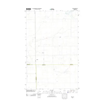
2013 Map of Skime
USGS Topo · Published 2013About this map
Skime sits at the heart of this landscape where the Roseau River and the S Fork Roseau River move through the lowlands of Northern Minnesota. This 2013 survey illustrates a rural region defined by its waterway systems and a grid of section roads like 460th Ave and 120th St. Local history is anchored by the presence of Bethesda Cem and Reine Cem, reflecting the enduring community ties in this corner of the state. The northern portion of the map is dominated by the waters of Hayes Lake, while the southern reaches are marked by the jurisdictional meeting of Roseau, Marshall, and Beltrami counties. The transition from the developed road network to the river-fed wetlands illustrates the remote character of this borderland territory.
Find a feature on this map
17 named features on this map. Tap any name to fly to it.
Don’t see what you’re looking for? This feature index may not catch every label — zoom into the map to look around manually.
Map Details
Editions of this 2013 Skime Map
This is the sole edition of this map. No revisions or reprints were ever made.
Other maps of this area

1918 · Pencer
USGS Topo · 1:62,500

1918 · Malcolm
USGS Topo · 1:62,500

1919 · Liner
USGS Topo · 1:62,500

1954 · Roseau
USGS Topo · 1:250,000

1957 · Roseau
USGS Topo · 1:250,000

1958 · Roseau
USGS Topo · 1:250,000
1967 · Wannaska
USGS Topo · 1:24,000
1967 · Wannaska NE
USGS Topo · 1:24,000

1968 · Mulligan Lake SW
USGS Topo · 1:24,000
1968 · Mulligan Lake NW
USGS Topo · 1:24,000