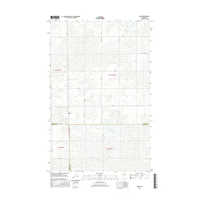
2016 Map of Skime
USGS Topo · Published 2016About this map
Skime anchors this 2016 survey of the Minnesota landscape, where the northern wetlands and forest meet the headwaters of the S Fork Roseau River. This region is defined by its large-scale section divisions and a grid of rural roads like Co Rd 18 and Co Hwy 1 that navigate a terrain dominated by marshes. The map provides essential data for genealogists tracing families in the area, clearly marking the locations of Bethesda Cem and Reine Cem. The presence of the Winner Forest Rd in the northeastern corner suggests the importance of timber and conservation in this corner of Roseau County. This edition captures the modern infrastructure of these rural townships, documenting the exact placement of local section lines and County Roads near the intersection of Roseau, Marshall, and Beltrami counties.
Find a feature on this map
28 named features on this map. Tap any name to fly to it.
Don’t see what you’re looking for? This feature index may not catch every label — zoom into the map to look around manually.
Map Details
Editions of this 2016 Skime Map
This is the sole edition of this map. No revisions or reprints were ever made.
Other maps of this area

1918 · Pencer
USGS Topo · 1:62,500

1918 · Malcolm
USGS Topo · 1:62,500

1919 · Liner
USGS Topo · 1:62,500

1954 · Roseau
USGS Topo · 1:250,000

1957 · Roseau
USGS Topo · 1:250,000

1958 · Roseau
USGS Topo · 1:250,000
1967 · Wannaska
USGS Topo · 1:24,000
1967 · Wannaska NE
USGS Topo · 1:24,000

1968 · Mulligan Lake SW
USGS Topo · 1:24,000
1968 · Mulligan Lake NW
USGS Topo · 1:24,000