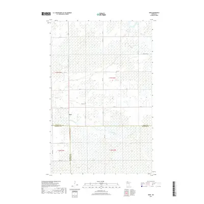
2019 Map of Skime
USGS Topo · Published 2019About this map
Skime marks the primary settlement in this northern Minnesota landscape where the counties of Roseau, Marshall, and Beltrami converge. The terrain is defined by the hydrologic network of the Roseau River and the S Fork Roseau River, which meander through a region characterized by extensive wetlands and sections of the Public Land Survey System. Genealogical interest is centered on the Bethesda Cem located along Co Rd 18 and the Reine Cem further north, which serve as long-standing landmarks for the local community. The grid of forest and county roads, including Winner Forest Rd and Co Hwy 1, facilitates movement through this low-lying territory where section lines and range boundaries like T159N R38W dictate the organization of the land.
Find a feature on this map
30 named features on this map. Tap any name to fly to it.
Don’t see what you’re looking for? This feature index may not catch every label — zoom into the map to look around manually.
Map Details
Editions of this 2019 Skime Map
This is the sole edition of this map. No revisions or reprints were ever made.
Other maps of this area

1918 · Pencer
USGS Topo · 1:62,500

1918 · Malcolm
USGS Topo · 1:62,500

1919 · Liner
USGS Topo · 1:62,500

1954 · Roseau
USGS Topo · 1:250,000

1957 · Roseau
USGS Topo · 1:250,000

1958 · Roseau
USGS Topo · 1:250,000
1967 · Wannaska
USGS Topo · 1:24,000
1967 · Wannaska NE
USGS Topo · 1:24,000

1968 · Mulligan Lake SW
USGS Topo · 1:24,000
1968 · Mulligan Lake NW
USGS Topo · 1:24,000