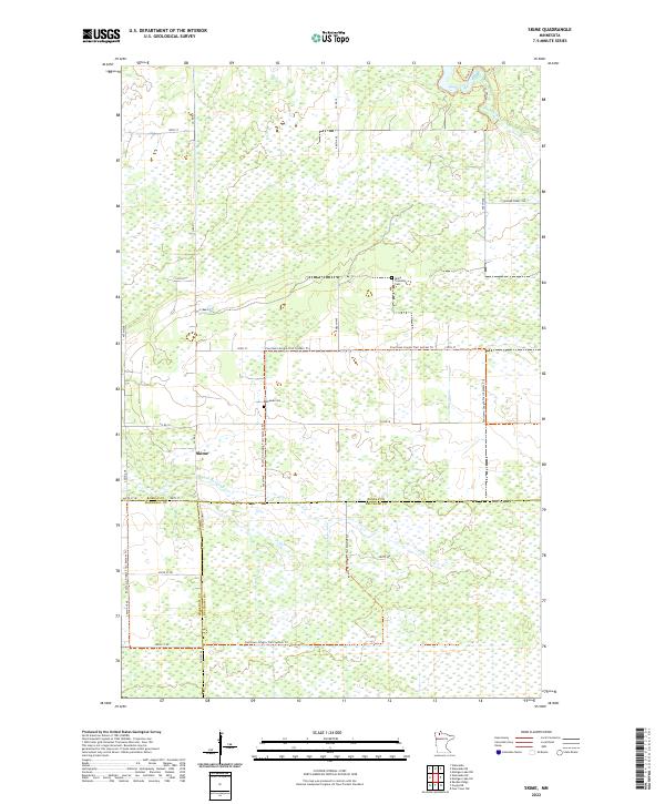
2022 Map of Skime
USGS Topo · Published 2022About this map
Skime sits at the junction of Co St Aid Hwy 1 and the S Fork Roseau River, serving as a central point in this low-lying wetland landscape. This modern topographic study shows the remote intersection of three northern Minnesota counties—Roseau, Marshall, and Beltrami—where the terrain is defined by the Roseau River and its various tributaries. The map reveals a community structured around local landmarks like the Reine Township Cem and Bethesda Cem, and it highlights the extensive network of the Fourtown-Grygla Trail System Trl which weaves through the region. Land use here is heavily oriented toward forestry and outdoor recreation, with numerous named routes such as Winner Forest Rd and Moose Trl cutting through the vast marshlands.
Find a feature on this map
33 named features on this map. Tap any name to fly to it.
Don’t see what you’re looking for? This feature index may not catch every label — zoom into the map to look around manually.
Map Details
Editions of this 2022 Skime Map
This is the sole edition of this map. No revisions or reprints were ever made.
Other maps of this area

1918 · Pencer
USGS Topo · 1:62,500

1918 · Malcolm
USGS Topo · 1:62,500

1919 · Liner
USGS Topo · 1:62,500

1954 · Roseau
USGS Topo · 1:250,000

1957 · Roseau
USGS Topo · 1:250,000

1958 · Roseau
USGS Topo · 1:250,000
1967 · Wannaska
USGS Topo · 1:24,000
1967 · Wannaska NE
USGS Topo · 1:24,000

1968 · Mulligan Lake SW
USGS Topo · 1:24,000
1968 · Mulligan Lake NW
USGS Topo · 1:24,000