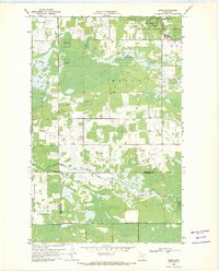
1969 Map of Skime
USGS Topo · Published 1971About this map
Reine and Golden Valley characterize this northern Minnesota landscape, where the South Fork Roseau River winds through a mosaic of wetlands and timber. The area is defined by the intersection of three counties—Roseau, Beltrami, and Marshall—and the northern boundary of the Red Lake Indian Reservation. The small settlement of Skime serves as a local hub near the Bethesda Ch, while Linsell anchors the southwestern portion of the sheet.
Find a feature on this map
20 named features on this map. Tap any name to fly to it.
Don’t see what you’re looking for? This feature index may not catch every label — zoom into the map to look around manually.
Map Details
Editions of this 1969 Skime Map
This is the sole edition of this map. No revisions or reprints were ever made.
Other maps of this area

1918 · Pencer
USGS Topo · 1:62,500

1918 · Malcolm
USGS Topo · 1:62,500

1919 · Liner
USGS Topo · 1:62,500

1954 · Roseau
USGS Topo · 1:250,000

1957 · Roseau
USGS Topo · 1:250,000

1958 · Roseau
USGS Topo · 1:250,000
1967 · Wannaska
USGS Topo · 1:24,000
1967 · Wannaska NE
USGS Topo · 1:24,000

1968 · Mulligan Lake SW
USGS Topo · 1:24,000
1968 · Mulligan Lake NW
USGS Topo · 1:24,000