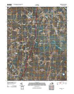
2010 Map of Skippers
USGS Topo · Published 2010About this map
Fountains Creek and its many tributaries, including Cattail Creek and Jacks Swamp, dominate this rural landscape on the Virginia and North Carolina border. The area is defined by a network of crossroads settlements and family-named landmarks that speak to generations of local history. Near Turners Crossroads, researchers can find the Vincent Cemetery and Wyche Cemetery, while Robinson Cemetery sits further west near the Robinson Dam. Industrial activity is evident at the Hitchcock Quarry and Trego Quarry, located north of Mitchells Mill. The transportation corridors are well-established, with Rolling Acres Rd and Diamond Grove Rd connecting the smaller communities of Dahlia and Brewers Crossroads to the regional hub at Skippers. This survey provides a clear view of the transition from industrial quarrying and agriculture to the recreation areas at Cattail Creek Campground.
Find a feature on this map
39 named features on this map. Tap any name to fly to it.
Don’t see what you’re looking for? This feature index may not catch every label — zoom into the map to look around manually.
Map Details
Editions of this 2010 Skippers Map
This is the sole edition of this map. No revisions or reprints were ever made.
Other maps of this area

1919 · Emporia
USGS Topo · 1:62,500

1919 · Arringdale
USGS Topo · 1:48,000

1920 · Arringdale
USGS Topo · 1:62,500

1942 · Arringdale
USGS Topo · 1:62,500

1942 · Emporia
USGS Topo · 1:62,500

1953 · Norfolk
USGS Topo · 1:250,000

1963 · Skippers
USGS Topo · 1:24,000

1963 · Barley
USGS Topo · 1:24,000

1963 · Emporia
USGS Topo · 1:24,000

1963 · Ante
USGS Topo · 1:24,000