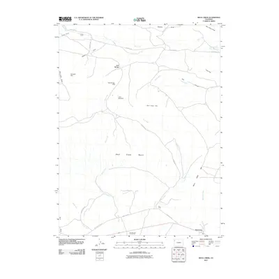
2010 Map of Skull Creek
USGS Topo · Published 2010About this map
Massadona lies at the southern edge of this landscape, positioned along the corridor that transitions into the expansive Skull Creek Basin. This 2010 topographic record illustrates a high-desert environment defined by complex drainage systems and family-named landmarks such as the Karren Ranch and Petes Post. Significant water features like the Peterson Post Flat Reservoir and the meandering The Sloughs highlight the management of water in this arid region, while the network of ephemeral washes including Miller Creek and Wolf Creek shape the floor of the basin.
Find a feature on this map
29 named features on this map. Tap any name to fly to it.
Don’t see what you’re looking for? This feature index may not catch every label — zoom into the map to look around manually.
Map Details
Editions of this 2010 Skull Creek Map
This is the sole edition of this map. No revisions or reprints were ever made.
Other maps of this area

1907 · Rangely
USGS Topo · 1:125,000

1910 · Rangely
USGS Topo · 1:125,000

1954 · Vernal
USGS Topo · 1:250,000

1958 · Vernal
USGS Topo · 1:250,000

1960 · Vernal
USGS Topo · 1:250,000

1962 · Lazy Y Point
USGS Topo · 1:24,000

1962 · Tanks Peak
USGS Topo · 1:24,000

1962 · Rangely NE
USGS Topo · 1:24,000

1962 · Cactus Reservoir
USGS Topo · 1:24,000
1962 · Divide Creek
USGS Topo · 1:24,000