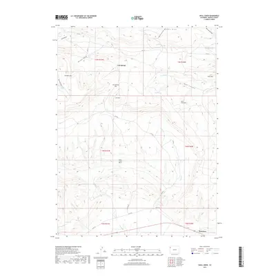
2019 Map of Skull Creek
USGS Topo · Published 2019About this map
Massadona sits at the base of a complex high-desert landscape defined by the prominent Skull Creek Rim and the expansive Skull Creek Basin. This 2019 survey documents a region of Northwest Colorado where water sources are vital local landmarks, as evidenced by the network of Jack Springs, Blair Spring, and Davidson Spring. The topography is marked by several significant draws, including Luxen Draw and Wasson Draw, which channel seasonal runoff through the arid terrain. Infrastructure is sparse but telling of the area's land use, with Old Mine Rd and Co RD 104 providing access to the interior. Notable elevations like Lone Mtn and the passage at Jack Springs Pass serve as natural waypoints between the drainage of Wolf Cr and the unique wetland features of The Sloughs.
Find a feature on this map
38 named features on this map. Tap any name to fly to it.
Don’t see what you’re looking for? This feature index may not catch every label — zoom into the map to look around manually.
Map Details
Editions of this 2019 Skull Creek Map
This is the sole edition of this map. No revisions or reprints were ever made.
Other maps of this area

1907 · Rangely
USGS Topo · 1:125,000

1910 · Rangely
USGS Topo · 1:125,000

1954 · Vernal
USGS Topo · 1:250,000

1958 · Vernal
USGS Topo · 1:250,000

1960 · Vernal
USGS Topo · 1:250,000

1962 · Lazy Y Point
USGS Topo · 1:24,000

1962 · Tanks Peak
USGS Topo · 1:24,000

1962 · Rangely NE
USGS Topo · 1:24,000

1962 · Cactus Reservoir
USGS Topo · 1:24,000
1962 · Divide Creek
USGS Topo · 1:24,000