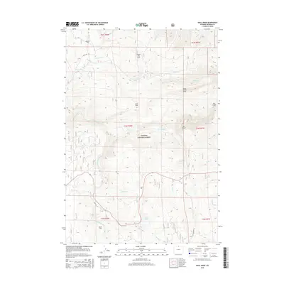
2015 Map of Skull Ridge
USGS Topo · Published 2015About this map
Bighorn National Forest defines the high-country character of this Sheridan County landscape, where the Tongue River and its numerous forks—including the North Tongue River and South Tongue River—carve through the Big Horn Mountains. The map documents an intricate network of waterways and early water management features such as the Eureka Ditch, which traverses the slopes near Sheep Cr. Historically significant naming conventions are evident in landmarks like Sawmill Flat and Shutts Flats, suggesting early logging or ranching activity in these elevated meadows. Prominent ridges and peaks, including Skull Ridge, Horse Creek Ridge, and Freeze Out Point, provide a detailed look at the topographic barriers that shaped travel routes like Black Mountain Rd and Freeze Out Rd. Recreation and land use are centered around water features like Sibley Lake and the dramatic geology of Box Canyon.
Find a feature on this map
39 named features on this map. Tap any name to fly to it.
Don’t see what you’re looking for? This feature index may not catch every label — zoom into the map to look around manually.
Map Details
Editions of this 2015 Skull Ridge Map
This is the sole edition of this map. No revisions or reprints were ever made.
Other maps of this area

1895 · Dayton
USGS Topo · 1:125,000

1898 · Bald Mountain
USGS Topo · 1:125,000

1901 · Dayton
USGS Topo · 1:125,000

1901 · Bald Mountain
USGS Topo · 1:125,000

1955 · Sheridan
USGS Topo · 1:250,000

1958 · Sheridan
USGS Topo · 1:250,000

1960 · Granite Pass
USGS Topo · 1:24,000

1962 · Sheridan
USGS Topo · 1:250,000
1964 · Burgess Junction
USGS Topo · 1:24,000
1964 · Dayton North
USGS Topo · 1:24,000