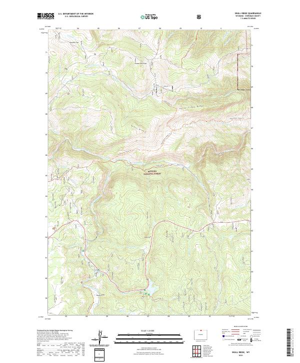
2021 Map of Skull Ridge
USGS Topo · Published 2021About this map
Bighorn National Forest dominates this high-altitude landscape, where the North Tongue River and South Tongue River converge to form the Tongue River. The terrain is defined by dramatic elevations and deep drainages, with Skull Ridge and Horse Creek Ridge providing significant high ground overlooking the river valleys. Cultural history is evident in the presence of Eureka Ditch, a mark of early water management in this arid region, and named gathering points like Shutts Flats and Sawmill Flat. A dense network of paths, including the Tongue River Canyon Trail and Prune Creek Trail, indicates the area's importance for transit and backcountry access through the mountains of Sheridan County. Notable landmarks such as Freeze Out Point and Cutler Hill serve as distinct navigational points for those studying the physical geography of the region.
Find a feature on this map
44 named features on this map. Tap any name to fly to it.
Don’t see what you’re looking for? This feature index may not catch every label — zoom into the map to look around manually.
Map Details
Editions of this 2021 Skull Ridge Map
This is the sole edition of this map. No revisions or reprints were ever made.
Other maps of this area

1895 · Dayton
USGS Topo · 1:125,000

1898 · Bald Mountain
USGS Topo · 1:125,000

1901 · Dayton
USGS Topo · 1:125,000

1901 · Bald Mountain
USGS Topo · 1:125,000

1955 · Sheridan
USGS Topo · 1:250,000

1958 · Sheridan
USGS Topo · 1:250,000

1960 · Granite Pass
USGS Topo · 1:24,000

1962 · Sheridan
USGS Topo · 1:250,000
1964 · Burgess Junction
USGS Topo · 1:24,000
1964 · Dayton North
USGS Topo · 1:24,000