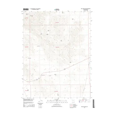
2014 Map of Skull Rock Pass
USGS Topo · Published 2014About this map
Skull Rock Pass serves as a critical desert corridor through the House Range in Millard County, Utah. This modern-era survey illustrates how Us-50, famously known as the loneliest road in America, cuts through the arid landscape between the Tule Valley and the Black Hills. The topography is defined by sharp canyons and secluded pockets such as Hell'n Moriah Kitchen and Sawtooth Cove, which highlight the complex drainage patterns and geological formations characteristic of the Great Basin. Landmark features like Skull Rock and The Stairs provide significant orientation points for travelers and geologists alike. The map also traces the winding path of Steamboat Pass Rd as it skirts the eastern boundary, connecting this high-altitude pass with broader regional transit routes.
Find a feature on this map
21 named features on this map. Tap any name to fly to it.
Don’t see what you’re looking for? This feature index may not catch every label — zoom into the map to look around manually.
Map Details
Editions of this 2014 Skull Rock Pass Map
This is the sole edition of this map. No revisions or reprints were ever made.
Other maps of this area

1908 · Fish Springs
USGS Topo · 1:250,000

1910 · Fish Springs
USGS Topo · 1:250,000

1953 · Richfield
USGS Topo · 1:250,000

1953 · Delta
USGS Topo · 1:250,000

1958 · Richfield
USGS Topo · 1:250,000

1958 · Delta
USGS Topo · 1:250,000

1960 · Notch Peak
USGS Topo · 1:62,500

1960 · The Barn
USGS Topo · 1:62,500

1962 · Delta
USGS Topo · 1:250,000
1972 · Needle Point
USGS Topo · 1:24,000