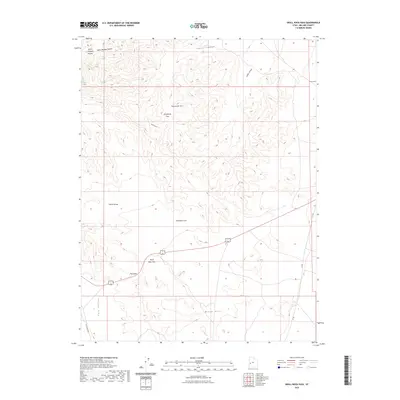
2023 Map of Skull Rock Pass
USGS Topo · Published 2023About this map
Skull Rock Pass serves as the central crossing point through the rugged House Range in Millard County, Utah. This modern topographic record illustrates a landscape of extreme vertical relief, where the steep ridgeline of Sawtooth Mtn drops sharply into the expansive Tule Valley to the west and Sawtooth Cove to the east. The geography is defined by narrow, high-altitude conduits and named rock formations, such as The Stairs and the uniquely titled Hell'n Moriah Kitchen.
Find a feature on this map
14 named features on this map. Tap any name to fly to it.
Don’t see what you’re looking for? This feature index may not catch every label — zoom into the map to look around manually.
Map Details
Editions of this 2023 Skull Rock Pass Map
This is the sole edition of this map. No revisions or reprints were ever made.
Other maps of this area

1908 · Fish Springs
USGS Topo · 1:250,000

1910 · Fish Springs
USGS Topo · 1:250,000

1953 · Richfield
USGS Topo · 1:250,000

1953 · Delta
USGS Topo · 1:250,000

1958 · Richfield
USGS Topo · 1:250,000

1958 · Delta
USGS Topo · 1:250,000

1960 · Notch Peak
USGS Topo · 1:62,500

1960 · The Barn
USGS Topo · 1:62,500

1962 · Delta
USGS Topo · 1:250,000
1972 · Needle Point
USGS Topo · 1:24,000