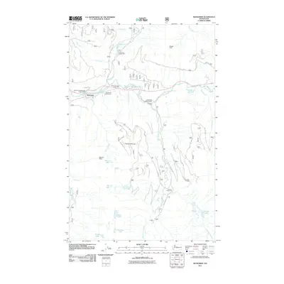
2011 Map of Skykomish
USGS Topo · Published 2011About this map
Skykomish serves as the central hub for this high-elevation landscape, where the South Fork Skykomish River and Tye River meet. The geography is defined by steep relief, anchored by Beckler Peak and Sobieski Mountain, while a network of glacial lakes including Maloney Lakes, Top Lake, and Evans Lake dot the higher ridges. The influence of the Forest Service is evident throughout the region, with the Skykomish District Ranger Office located near the town center and multiple recreational sites such as the Beckler River Campground and Foss River Camp established along the valley floors.
Find a feature on this map
47 named features on this map. Tap any name to fly to it.
Don’t see what you’re looking for? This feature index may not catch every label — zoom into the map to look around manually.
Map Details
Editions of this 2011 Skykomish Map
This is the sole edition of this map. No revisions or reprints were ever made.
Other maps of this area

1902 · Skykomish
USGS Topo · 1:125,000

1905 · Skykomish
USGS Topo · 1:125,000

1957 · Wenatchee
USGS Topo · 1:250,000

1965 · Captain Point
USGS Topo · 1:24,000

1965 · Evergreen Mtn
USGS Topo · 1:24,000

1965 · Grotto
USGS Topo · 1:24,000

1965 · Mount Daniel
USGS Topo · 1:24,000

1965 · Skykomish
USGS Topo · 1:24,000
1965 · Baring
USGS Topo · 1:24,000
1965 · Snoqualmie Lake
USGS Topo · 1:24,000