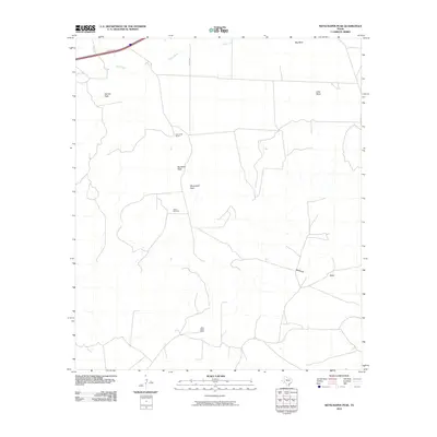
2010 Map of Skyscraper Peak
USGS Topo · Published 2010About this map
Skyscraper Peak and Big Baldy Peak rise above the high plains of Pecos County in this early 21st-century documentation of the Texas landscape. The region's economy is anchored by cattle ranching and energy production, evidenced by the presence of Escondido Ranch to the north and the Jasper Gas Plant centrally located near the peaks. Transportation across this expansive terrain relies on a sparse network of local tracks, including Pvt Rd 5728, and the vital Frontage Rd corridor following the interstate in the northwest corner.
Find a feature on this map
12 named features on this map. Tap any name to fly to it.
Don’t see what you’re looking for? This feature index may not catch every label — zoom into the map to look around manually.
Map Details
Editions of this 2010 Skyscraper Peak Map
This is the sole edition of this map. No revisions or reprints were ever made.
Other maps of this area

1928 · Comanche Spring
USGS Topo · 1:125,000

1929 · Independence Draw Quadrangle
USGS Topo · 1:125,000

1954 · Fort Stockton
USGS Topo · 1:250,000

1958 · Fort Stockton
USGS Topo · 1:250,000

1969 · Bootleg Canyon
USGS Topo · 1:24,000

1969 · Skyscraper Peak
USGS Topo · 1:24,000

1969 · Hackberry Draw NW
USGS Topo · 1:24,000

1969 · Hackberry Draw NE
USGS Topo · 1:24,000

1969 · Bakersfield
USGS Topo · 1:24,000
1969 · Sherbino Mesa
USGS Topo · 1:24,000