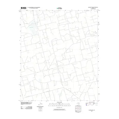
2010 Map of Slager Lake
USGS Topo · Published 2010About this map
Slager Lake sits at the heart of this landscape in the southern High Plains of Reagan County. The 2010 survey reflects a region primarily organized by industrial and agricultural transport routes rather than dense residential settlements. A geometric network of roads, including Water Station Rd and Southland Royalty Rd, suggests the area's development around resource extraction and livestock management. These corridors, along with Fm 1357 and family-named routes like Proctor Dr, provide a clear picture of how land was partitioned and accessed in the early 21st century. The sparse distribution of labels indicates a quiet, open environment where water features and specialized utility roads like Canal Rd define the local geography.
Find a feature on this map
13 named features on this map. Tap any name to fly to it.
Don’t see what you’re looking for? This feature index may not catch every label — zoom into the map to look around manually.
Map Details
Editions of this 2010 Slager Lake Map
This is the sole edition of this map. No revisions or reprints were ever made.
Other maps of this area

1928 · Rankin
USGS Topo · 1:125,000

1954 · San Angelo
USGS Topo · 1:250,000

1958 · San Angelo
USGS Topo · 1:250,000

1965 · San Angelo
USGS Topo · 1:250,000

1967 · Midkiff
USGS Topo · 1:24,000

1968 · Midkiff SE
USGS Topo · 1:24,000

1970 · Sevenmile Corner NE
USGS Topo · 1:24,000

1970 · Stiles NW
USGS Topo · 1:24,000

1970 · Stiles
USGS Topo · 1:24,000

1973 · Saint Lawrence SE
USGS Topo · 1:24,000