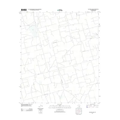
2012 Map of Slager Lake
USGS Topo · Published 2012About this map
Slager Lake and the arid Permian Basin landscape dominate this Reagan County survey, revealing a territory defined by industrial access and water management. The road network is a grid of utilitarian routes, including Tank Farm Rd and Water Station Rd, which speak to the local infrastructure required for oil production and ranching. The presence of Southland Royalty indicates the heavy footprint of energy companies in this part of West Texas during the early 21st century. Secondary roads like Cotton Flat Rd and Dumas Rd crisscross the landscape, connecting scattered structures and specialized facilities. This survey captures the region at a time when the traditional agricultural landscape had become deeply integrated with the logistical demands of the modern oil field, creating a unique pattern of land use centered around isolated points of extraction and water resources.
Find a feature on this map
13 named features on this map. Tap any name to fly to it.
Don’t see what you’re looking for? This feature index may not catch every label — zoom into the map to look around manually.
Map Details
Editions of this 2012 Slager Lake Map
This is the sole edition of this map. No revisions or reprints were ever made.
Other maps of this area

1928 · Rankin
USGS Topo · 1:125,000

1954 · San Angelo
USGS Topo · 1:250,000

1958 · San Angelo
USGS Topo · 1:250,000

1965 · San Angelo
USGS Topo · 1:250,000

1967 · Midkiff
USGS Topo · 1:24,000

1968 · Midkiff SE
USGS Topo · 1:24,000

1970 · Sevenmile Corner NE
USGS Topo · 1:24,000

1970 · Stiles NW
USGS Topo · 1:24,000

1970 · Stiles
USGS Topo · 1:24,000

1973 · Saint Lawrence SE
USGS Topo · 1:24,000