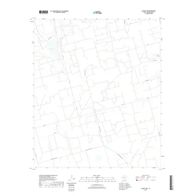
2019 Map of Slager Lake
USGS Topo · Published 2019About this map
Slager Lake sits at the heart of this Permian Basin landscape in Reagan County, reflecting the region's industrial and agricultural character. The terrain is defined by an extensive grid of service roads and thoroughfares that support the local energy and ranching economy, including the prominent Southland Royalty Rd and Water Station Rd. The presence of Tank Farm Rd and Cotton Flat Rd points to the area's specific uses, where oil and gas infrastructure often intersects with traditional land divisions. Secondary routes like Proctor Dr, Byrd Rd, and Daniel Rd connect remote properties to the primary artery of Fm 1357, which serves as the backbone for travel through this part of West Texas.
Find a feature on this map
14 named features on this map. Tap any name to fly to it.
Don’t see what you’re looking for? This feature index may not catch every label — zoom into the map to look around manually.
Map Details
Editions of this 2019 Slager Lake Map
This is the sole edition of this map. No revisions or reprints were ever made.
Other maps of this area

1928 · Rankin
USGS Topo · 1:125,000

1954 · San Angelo
USGS Topo · 1:250,000

1958 · San Angelo
USGS Topo · 1:250,000

1965 · San Angelo
USGS Topo · 1:250,000

1967 · Midkiff
USGS Topo · 1:24,000

1968 · Midkiff SE
USGS Topo · 1:24,000

1970 · Sevenmile Corner NE
USGS Topo · 1:24,000

1970 · Stiles NW
USGS Topo · 1:24,000

1970 · Stiles
USGS Topo · 1:24,000

1973 · Saint Lawrence SE
USGS Topo · 1:24,000