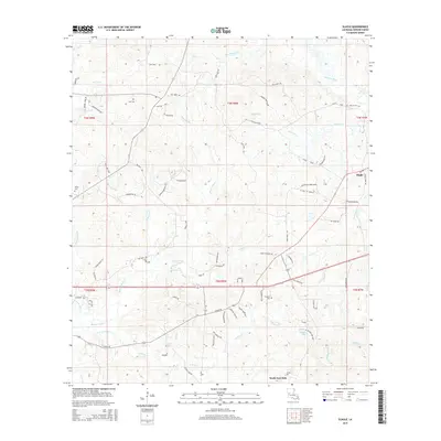
2015 Map of Slagle
USGS Topo · Published 2015About this map
Slagle and the northern reaches of North Fort Polk anchor this landscape in Vernon Parish, where the geography is defined by a dense network of winding watercourses. Significant drainages like Bayou Castor, Whisky Chitto Cr, and Cypress Cr carve through the terrain, accompanied by smaller local landmarks such as Pond Br and Blackland Br. For those tracing local history, several family-named burial sites are recorded across the quadrangle, including Self Cem, Smart Cem, and Antioch Cem. The road network is particularly distinctive, featuring many private or local loops like the Alligator Lake Loop and Bolgiano Loop, alongside timber-related thoroughfares such as Tank Trail RD. This pattern of lakes like Castor Lake and Alligator Lake among the creek bottoms reflects the hydraulic character of the Louisiana pinewoods region during the early 21st century.
Find a feature on this map
83 named features on this map. Tap any name to fly to it.
Don’t see what you’re looking for? This feature index may not catch every label — zoom into the map to look around manually.
Map Details
Editions of this 2015 Slagle Map
This is the sole edition of this map. No revisions or reprints were ever made.
Other maps of this area

1941 · Leesville
USGS Topo · 1:62,500

1941 · Slagle
USGS Topo · 1:62,500

1942 · Florien
USGS Topo · 1:62,500

1942 · Kisatchie
USGS Topo · 1:62,500

1943 · Leesville
USGS Topo · 1:62,500

1943 · Kisatchie
USGS Topo · 1:62,500

1944 · Florien
USGS Topo · 1:62,500

1944 · Slagle
USGS Topo · 1:62,500

1946 · Leesville
USGS Topo · 1:62,500

1948 · Leesville
USGS Topo · 1:62,500