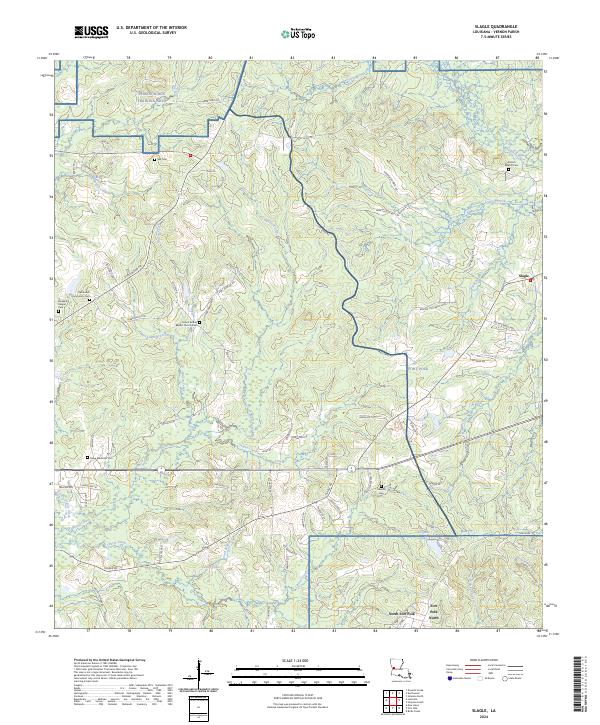
2024 Map of Slagle
USGS Topo · Published 2024About this map
Fort Polk and the Peason Ridge Training Area dominate the landscape of Vernon Parish, illustrating the significant military footprint in central Louisiana. This modern survey details the sprawling installation alongside the rural community of Slagle, where a network of family-named roads like Earl Haymon Rd and Gary Hunt Rd connects scattered homesteads. The geography is defined by a dense concentration of small burial grounds, including the Mount Bethel Baptist Church Cem, Antioch Baptist Cem, and Oak Forest Community Cem, which serve as vital markers for local genealogists.
Find a feature on this map
88 named features on this map. Tap any name to fly to it.
Don’t see what you’re looking for? This feature index may not catch every label — zoom into the map to look around manually.
Map Details
Editions of this 2024 Slagle Map
This is the sole edition of this map. No revisions or reprints were ever made.
Other maps of this area

1941 · Leesville
USGS Topo · 1:62,500

1941 · Slagle
USGS Topo · 1:62,500

1942 · Florien
USGS Topo · 1:62,500

1942 · Kisatchie
USGS Topo · 1:62,500

1943 · Leesville
USGS Topo · 1:62,500

1943 · Kisatchie
USGS Topo · 1:62,500

1944 · Florien
USGS Topo · 1:62,500

1944 · Slagle
USGS Topo · 1:62,500

1946 · Leesville
USGS Topo · 1:62,500

1948 · Leesville
USGS Topo · 1:62,500