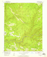
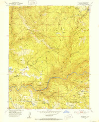
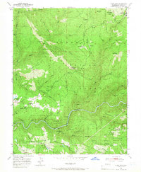
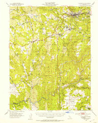
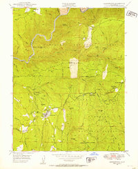
1950 Map of Slate Mtn
USGS Topo · Published 1959About this map
The Slate Mountains dominate this 1950s terrain within the Eldorado National Forest, revealing a landscape defined by timber extraction and early hydroelectric development. The South Fork American River carves through the lower half of the quadrangle, where the American River Intake Dam and a system of flumes and chutes highlight the era's water management. Evidence of the region’s shifting economy is visible in the numerous industrial markings, including a Dismantled Logging Railroad near Soapweed Creek and the inactive Slate Mtn Mine. Small residential and ranching pockets like Morton Ranch and Iowa Hill are scattered among the steep canyons, while the Mosquito District Sch serves the local community. Higher elevations are marked by the Slate Mtn Lookout and the Blodgett Experimental Forest, showing the intersection of forest service management and scientific study in the mid-century Sierra Nevada foothills.
Find a feature on this map
61 named features on this map. Tap any name to fly to it.
Don’t see what you’re looking for? This feature index may not catch every label — zoom into the map to look around manually.
Map Details
Editions of this 1950 Slate Mtn Map
4 editions found

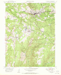
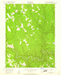
Other maps of this area

1891 · Placerville
USGS Topo · 1:125,000

1892 · Placerville
USGS Topo · 1:125,000

1893 · Placerville
USGS Topo · 1:125,000

1947 · Sacramento
USGS Topo · 1:250,000

1948 · Sacramento
USGS Topo · 1:250,000

1949 · Georgetown
USGS Topo · 1:62,500
1949 · Placerville
USGS Topo · 1:62,500
1949 · Georgetown
USGS Topo · 1:24,000
1949 · Placerville
USGS Topo · 1:24,000
1949 · Garden Valley
USGS Topo · 1:24,000