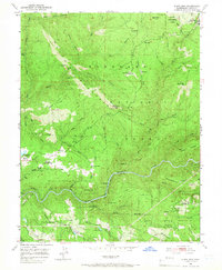
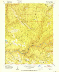
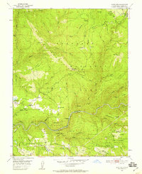
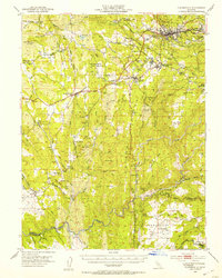
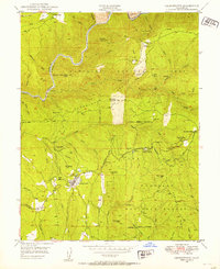
1950 Map of Slate Mtn
USGS Topo · Published 1966About this map
The South Fork American River carves through the heart of this landscape, anchoring a region defined by early timber and mining operations within the Eldorado National Forest. The presence of a Logging Railroad near Pino Grande and a Dismantled Railroad north of Big X Mtn indicates the area's transition away from rail-dependent industry by mid-century. Evidence of earlier extraction is found at the Slate Mtn Mine and Badger Hill Mine, while a Sawmill and the Mosquito District Sch suggest a settled community near the Finnon Res Spillway. In the north, the Blodgett Experimental Forest sits near high peaks like Sand Mtn. Water management for the region is clearly marked by the American River Intake Dam and various systems including a Plume and Chute near Slab Creek.
Find a feature on this map
62 named features on this map. Tap any name to fly to it.
Don’t see what you’re looking for? This feature index may not catch every label — zoom into the map to look around manually.
Map Details
Editions of this 1950 Slate Mtn Map
4 editions found

Other maps of this area

1891 · Placerville
USGS Topo · 1:125,000

1892 · Placerville
USGS Topo · 1:125,000

1893 · Placerville
USGS Topo · 1:125,000

1947 · Sacramento
USGS Topo · 1:250,000

1948 · Sacramento
USGS Topo · 1:250,000

1949 · Georgetown
USGS Topo · 1:62,500
1949 · Placerville
USGS Topo · 1:62,500
1949 · Georgetown
USGS Topo · 1:24,000
1949 · Placerville
USGS Topo · 1:24,000
1949 · Garden Valley
USGS Topo · 1:24,000