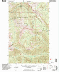
2002 Map of Slate Peak
USGS Topo · Published 2006About this map
Slate Peak and the surrounding high country of the North Cascades are documented here at the turn of the 21st century. This area, shared between the Mt Baker Snoqualmie National Forest and the Okanogan National Forest, highlights a landscape defined by its mining history and modern wilderness status. The presence of the Illinois Mine, Goat Mine, Whistler Mine, and Brown Bear Mine indicates a legacy of resource extraction that preceded the region's conservation.
Find a feature on this map
41 named features on this map. Tap any name to fly to it.
Don’t see what you’re looking for? This feature index may not catch every label — zoom into the map to look around manually.
Map Details
Editions of this 2002 Slate Peak Map
This is the sole edition of this map. No revisions or reprints were ever made.
Other maps of this area

1920 · Slate Pass
USGS Topo · 1:125,000

1955 · Concrete
USGS Topo · 1:250,000

1958 · Concrete
USGS Topo · 1:250,000

1962 · Concrete
USGS Topo · 1:250,000

1963 · Washington Pass
USGS Topo · 1:24,000

1963 · Azurite Peak
USGS Topo · 1:24,000

1963 · Slate Peak
USGS Topo · 1:24,000
1963 · Mt. Arriva
USGS Topo · 1:24,000

1963 · Silver Star Mtn.
USGS Topo · 1:24,000
1963 · Robinson Mtn.
USGS Topo · 1:24,000