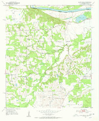
1951 Map of Slate Shoals
USGS Topo · Published 1952About this map
The Red River corridor along the border of Oklahoma and Texas defines this early 1950s survey, showing a landscape of small farming communities and scattered rural institutions. The settlement of Slate Shoals sits near the river's edge, while Medill and Novice serve as inland hubs for the surrounding countryside. This era captures a transition in rural education and worship, noting active sites like the Lone Star Sch and Bradley Ch alongside the Pee Dee Sch (Abandoned).
Find a feature on this map
25 named features on this map. Tap any name to fly to it.
Don’t see what you’re looking for? This feature index may not catch every label — zoom into the map to look around manually.
Map Details
Editions of this 1951 Slate Shoals Map
Other maps of this area

1903 · Paris
USGS Topo · 1:125,000

1948 · Grant
USGS Topo · 1:62,500

1948 · Paris
USGS Topo · 1:62,500

1949 · Grant
USGS Topo · 1:62,500

1949 · Paris
USGS Topo · 1:62,500

1951 · Slate Shoals
USGS Topo · 1:24,000

1951 · Frogville
USGS Topo · 1:24,000

1951 · Shoals
USGS Topo · 1:24,000

1951 · Woodland
USGS Topo · 1:24,000

1953 · Texarkana
USGS Topo · 1:250,000